
Take a gander at our FTC disclosure opus here. Updated Dec 4, 2025, this article contains one or more maps ...
Starved Rock Can Satisfy Your Appetite
One of the detriments to living in Chicago can also be a benefit. Aside from riding the beautiful Sheridan Road along the lakefront, accept that you'll need to slab the expressway for an hour to reach good roads. Highways can replace expressways but then suburban congestion usually increases the time it takes to get to roads worth riding. Yes, this sucks ... a waste of time that contributes to squared tires, etc. but it does have some benefits. Once you surrender to the hour in transit to better riding, there are upsides. One of which is the route to Starved Rock.
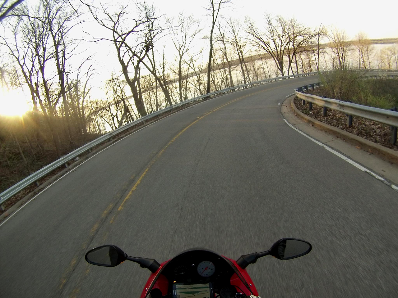
“At starved rock, riders trade highway miles for sweepers, river views and small town stops, then chase the twisty payoff on Route 71.”
Sixty minutes is the average length of many podcasts. I often use this opportunity to catch up on my queue (really helps those expressway miles fly by). I'll add that TRO podcasts are very well suited for times like these. One benefit in having to travel an hour is that there are options. I don't always have to go North to Wisconsin for a good day trip. Anyone who has spent time around Chicago knows the unpredictability of the weather. They'll also note how a crappy day on the Northside could be a different story on the Southside.
My rides usually fall into three categories: day trips, weekends in the Driftless or prolonged road trips. I've ridden Driftless Wisconsin in a day but when I'm North, I prefer staying for a while. My day trips usually involve Kettle Moraine Wisconsin, taking I-94 an hour north to Kenosha or Bristol where I'm quickly awash in sweepers and sprawling scenery (prairies, farms, lakes and woods).
I usually make a pit stop upon exiting the expressway to fuel the bike and body. I've always liked the stark contrast of the before and after. I tuck away the I-pass, turn off the podcast and focus on the rural roads and surroundings. A different kind of lifestyle, along with different roads, promptly envelops me. It lets me ride my bike the way its designers intended it to be ridden.
Riding South, A Twisty Payoff
Sometimes, especially between seasons, the weather is not so conducive up North but may be more compelling to the south. There are many things to factor in the decision at times like this, such as temperature, wind, flooding and other road conditions such as residual salt/sand. Sometimes, south is the way to travel to avoid the gusts, gain some degrees of temp or miss the rain. I don't day trip south often but when I do, I choose Starved Rock.

I've basically modified, extended and pieced together two routes from other websites. I started riding in this area years ago when a friend and I stumbled upon Old Stage Road. Yes, it was an old stagecoach route. Its wide-open sweepers without crossroads prompted me to open it up on my 77' CB550, leaving my friend behind. He was certain he'd find me in a twisted wreck around a bend when he caught up with me "riding that old bike like a maniac". I was waiting for him at the side of a straightway grinning from ear to ear.
Our Starved Rock Motorcycle Map
One of us noted we can't be too far from Starved Rock. We set forth to make our way there and, of course, proceeded to get lost. These were the days before smartphones. We then stumbled upon a few points of interest but didn't get to Starved Rock. For my next attempt, I looked on Google Maps and also found a couple motorcycle routes heading the right direction. I came up with my own handwritten route that I put in the clear pocket of a tank bag. I don't miss those days.

All hail technology! I changed it once, tweaked it a few times and came up with this. There are always options and everyone has their preferences. I do sometimes call an audible but this route is fun, scenic and reliable. There's just enough opportunity for technical riding. I set criteria for each ride and if I miss any, I go back the next day to get them. If I'm in Lower Kettle Moraine and don't hit Waterville Road, you can be sure I'll leave work early the next day and return.
It's like an itch that persists until you scratch it.
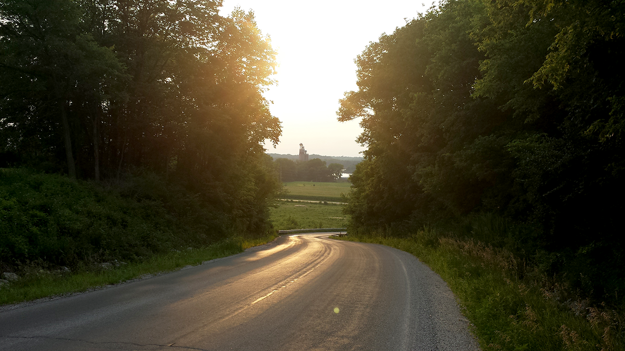
That being said, this Starved Rock route keeps the itching at bay, at least until next week. The only real twisties are on Route 71 in the park and I strongly recommend doing whatever it takes to avoid getting stuck behind a slow roller there. There are plenty of nice sweepers, interesting and breathtaking scenery and cool little towns to stop in along the route.

It's always good to take in the rural eye candy between each town.
Starved Rock Bike & Hike (Hiking Trails)
The whole route from start to finish is only an hour, so I always ride it complete in both directions. I also throw some hiking shoes in my side cases to really make the trek south worthwhile. I like the diversion of hiking to fully immerse myself in the beauty of the nature I've been whizzing by and it's also nice to get some exercise. My informative and sometimes annoying cell phone activity-tracking app indicates I only get, at best, 1/4 of a normal day's activity when riding. The combination of eating, hiking and replenishing with water leaves me rejuvenated for the route reversal.

There are 10 trails at Starved Rock to choose from that are as long as 4.7 miles and as short as 0.3 miles - you can do that in your cycle boots! Matthiessen and Buffalo Rock state parks are also nearby and offer sights and hiking that are equally amazing and less crowded. My "go-to" hike at Starved Rock is the St. Louis Canyon 1.5-mile hike, which can be especially cool in the early spring if the icefall has not melted yet.
This route starts/ends at the parking lot at The Lodge at Starved Rock. You can access many of the trails from here. I've eaten the brunch buffet here but prefer a sandwich or cup of chili at the cafe at the other end of the lodge. It's quicker, lighter and more conducive to bike 'n' hikin'.
Out On The Town(s)
This route will take you through the towns of Morris, Seneca, Marseilles and Ottawa.
You'll hit the main drags of Morris and Seneca and avoid them in Marseilles and Ottawa. These are my preferences of what I like to experience. Most people divert north to State Street in Ottawa, which looks more tempting on a map. My experience informs me the prolonged travel along the river's edge on Route 71 is not nearly as rewarding as it appears to be on a map.
The traffic congestion in downtown Ottawa also changes my mindset ... it takes me out of my zone.
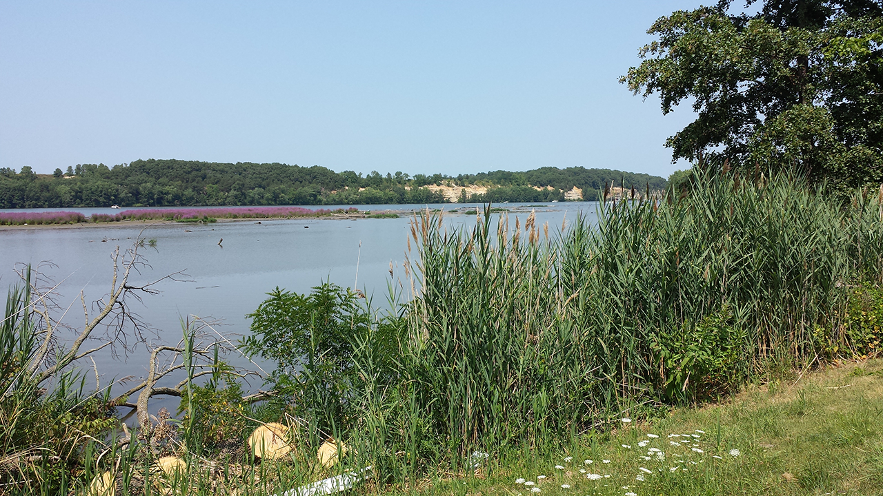
I always stressed about trying to find my turn at Gentleman Road on the return trip. My curiosity to find out "what's up that hill?" at Fosse Road (N 2650th Road) led to the answer "not much," but you get a few nice curves before they disappear and I prefer to avoid the chaos of Ottawa. I also found that the view coming down off that hill on Fosse Road, overlooking the fields along Route 71, with the Illinois River in the background, is one of my favorites.
Speaking of preferences, I like to get an early start and get my breakfast in Morris. It's an old town (1849) with lots of character-and characters. It checks a lot of boxes for criteria of small town America. You can use Armstrong Street to avoid the main drag ... but why? I see a lot of Harleys in front of bars in Morris that probably have good food but I opt for the local flavor. Places like the step back in time at Weitz Cafe or the surprisingly authentic Tobby's Mexi-Mart and Restaurant are good examples. They're both on Liberty Street. There's also a bevy of other good eats and treats.
Classic Car Night
Morris hosts a classic car night every second Saturday - June through October - and I invariably hit this on the way back. I've never known their schedule but just get lucky often. It's a great opportunity to see some nice rides and chat up some old-timers about their hot-roddin' days. As is evident in the variety of vehicles (including a tractor) in the pic below, it's more than just a typical muscle car night in the burbs and has hosted as many as 972 cars from eleven states.

The entry fee for participating vehicles also benefits some outstanding charities.
Solutions & Sidetracks
The route's start/end points are interchangeable depending on where you're coming from. I use the Osmand app for navigating GPX routes and can reverse them with the push of a button. You can find other software solutions here.
Departing from Chicago, I let the Waze app tell me the quickest route to Bell Road and Route 6 in Channahon. It usually takes an hour to get there and spits me off I-55 onto Route 6, which is what many people take all the way to Starved Rock. I should add that I-55 seems to have had a resurfacing, losing the craters and jarring breaks in the pavement until ten miles from Route 6.
At that point, it's best to pick a lane and stay in the middle of it to avoid the intermittent craters separating each lane. Looking at the map you can see this route follows the same trajectory as Route 6. It just hugs the rivers more closely and is therefore more winding, scenic and interesting.
Noteworthy Points of Interest
Before you scoff at Route 6, know that if you have not had your fill after arriving at or returning to Channahon, you can continue east on Route 6 to Joliet and then divert north on Route 171 toward Waterfall Glen, the Hindu Temple of Greater Chicago or continue on Route 171 to some "pretty okay" riding and sights around the woods, sloughs and lakes southeast of Archer Avenue between Lemont and Willow Springs.
The Hindu temple is quite a sight to see even if just passing by. As a bonus, there's a short/sweet little Bluff Road diversion just south of the temple, heading west off Lemont Road. You can find other ways to extend the outing into a full day along Route 171 in Lockport. The Gaylord Building, Lincoln Landing and Historical Museum are all within a block of each other.
While in this area, you can also visit the Little Red Schoolhouse Nature Center. When I've continued this far, I usually stop at Ashbary Coffee House in Willow Springs for some hippie food and a caffeine boost before jumping on I-294 and heading home.

Road Conditions
Road conditions on this route have varied throughout the years, with Hansel and Cemetery Roads being the most unpredictable. I was pleasantly surprised on my most recent visit (3/4/2018) to find all roads in great shape, with one exception. The usual spot on Hansel Road, just west of Ridge Road at the 1st nice dip heading west, leads to brief uneven pavement and maybe even pooled water. You also want to be mindful a little further west on Hansel Road during Autumn as Dollinger Family Farm is a hot spot for all things pumpkin.
If there's traffic, it won't last long. In fact, traffic throughout the entire route moves pretty swiftly. It consists mostly of cycles and sports cars.
... Except for the time I got stuck behind a historic tractor parade. Now that was something to see!
What Illinois Motorcycle Routes Do You Enjoy?
Illinois is home to a lot of hidden gems for motorcycling. Which one do you favor and why? Your input is invited. Leave a comment and/or write an article!
Share Link ...
About Tom Burns
Tom Burns is a long time sport bike enthusiast who's love of travel is surpassed only by his drive to obtain time to do so. His current flock includes a Honda Superhawk and VFR Interceptor.


Comments
Starved Rock is on the docket as my first or second all-day trip - homebase is Deerfield IL. (The other one is to visit a friend in La Porte IN... but getting around Chicago and back in a day? Eesh.)
Here's a route I found awhile back and stashed away - I look forward to comparing details with yours, above.
Of making one's way south: any thoughts on 355 v 294? I haven't driven 355.
Hey Julie, your route is typical of most people's belief that the only good riding in the area is between Ottowa and Starved Rock. While the best road is within the park, the purpose of this article is to illustrate that fun can be had all the way to Channahon. Give it a try.
I tried to avoid the expressway once and find a decent highway route to/from Channahon but was unsuccessful. I realized that for me it's better to bite the bullet and get to Shannahon as quick as I can and let the fun begin there.
Thoughts gone wild? Write an article!